
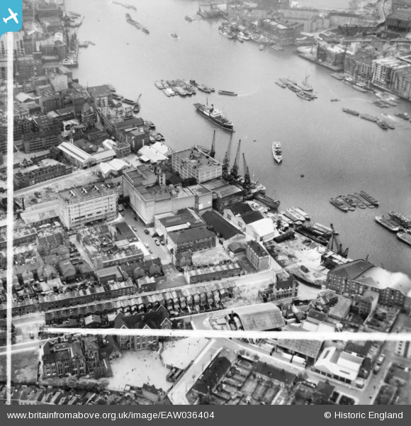
eaw036404 ENGLAND (1951). Chambers Wharf, Chambers Street and environs, Bermondsey, 1951. This image has been produced from a print marked by Aerofilms Ltd for photo editing.
© Copyright OpenStreetMap contributors and licensed by the OpenStreetMap Foundation. 2026. Cartography is licensed as CC BY-SA.
Nearby Images (10)
EAW036404

EAW036403

EAW036396

EAW036402

EAW036400

EAW036401

EAW036397

EAW036398

EAW036399

EAW036405

Details
| Title | [EAW036404] Chambers Wharf, Chambers Street and environs, Bermondsey, 1951. This image has been produced from a print marked by Aerofilms Ltd for photo editing. |
| Reference | EAW036404 |
| Date | 29-May-1951 |
| Link | |
| Place name | BERMONDSEY |
| Parish | |
| District | |
| Country | ENGLAND |
| Easting / Northing | 534352, 179741 |
| Longitude / Latitude | -0.064173496158661, 51.500134349029 |
| National Grid Reference | TQ344797 |
Pins

Robin |
Friday 26th of March 2021 04:09:36 PM |