
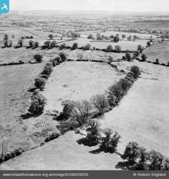
eaw029550 ENGLAND (1950). The disused stone quarries on Quainton Hill, Conduit Hill, from the north-west, 1950
© Copyright OpenStreetMap contributors and licensed by the OpenStreetMap Foundation. 2026. Cartography is licensed as CC BY-SA.
Details
| Title | [EAW029550] The disused stone quarries on Quainton Hill, Conduit Hill, from the north-west, 1950 |
| Reference | EAW029550 |
| Date | 22-May-1950 |
| Link | |
| Place name | CONDUIT HILL |
| Parish | HOGSHAW |
| District | |
| Country | ENGLAND |
| Easting / Northing | 474831, 221926 |
| Longitude / Latitude | -0.91250527076349, 51.89042079737 |
| National Grid Reference | SP748219 |
Pins

Class31 |
Monday 14th of July 2014 03:09:33 PM | |

nkingdon |
Monday 14th of July 2014 02:51:44 PM | |
|
nkingdon |
Monday 14th of July 2014 02:46:04 PM | |
I hadn't spotted the railway in this picture but it's definitely there. |
Class31 |
Monday 14th of July 2014 03:16:49 PM |
|
nkingdon |
Monday 14th of July 2014 02:38:55 PM | |
|
nkingdon |
Monday 14th of July 2014 02:30:06 PM | |
|
Class31 |
Monday 28th of April 2014 09:06:15 AM | |
I think that this could be the Chinnor Cement Works with the Chilterns beyond. |
Class31 |
Thursday 8th of May 2014 06:07:50 PM |
Could also be Pitstone Cement Works. I could also be wrong! |
Class31 |
Thursday 8th of May 2014 07:14:41 PM |
I think this is the 'Old Works' on the Bicester Rd leaving Aylesbury; now under Tesco's carpark. |
nkingdon |
Monday 14th of July 2014 02:36:41 PM |
|
Class31 |
Monday 28th of April 2014 09:04:51 AM |
User Comment Contributions
This is Quainton Hill, looking southwards. |
nkingdon |
Monday 11th of August 2014 11:23:00 AM |
Hi nkingdon, Thanks for the location. We’ll update the catalogue and post your new data here in due course. Yours, Katy Britain from Above Cataloguing Team Leader |
Katy Whitaker |
Monday 11th of August 2014 11:23:00 AM |
I agree with nkingdon's location of Quainton Hill. The local field boundaries fit and the covered reservoir is there. |
Class31 |
Monday 14th of July 2014 03:24:04 PM |
The triangulation point for Quainton Hill is actually on the covered reservoir, see http://www.geograph.org.uk/photo/3573415 |
Class31 |
Monday 14th of July 2014 03:13:42 PM |