
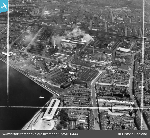
eaw016444 ENGLAND (1948). The McKechnie Bros Ltd Works and environs, Rotton Park, 1948. This image has been produced from a print marked by Aerofilms Ltd for photo editing.
© Copyright OpenStreetMap contributors and licensed by the OpenStreetMap Foundation. 2024. Cartography is licensed as CC BY-SA.
Nearby Images (18)
EAW016444

EAW016441

EAW016442

EAW016443

EAW009975

EPW035925

EPW047137

EPW009721

EAW009968

EPW035928

EPW054219

EPW035927

EPW047129

EAW009967

EAW009969

EAW016445

EAW009977

EAW016439
 and environs, Rotton Park, 1948. This image has been produced from a damaged negative.")
Details
| Title | [EAW016444] The McKechnie Bros Ltd Works and environs, Rotton Park, 1948. This image has been produced from a print marked by Aerofilms Ltd for photo editing. |
| Reference | EAW016444 |
| Date | 9-June-1948 |
| Link | |
| Place name | ROTTON PARK |
| Parish | |
| District | |
| Country | ENGLAND |
| Easting / Northing | 404753, 286985 |
| Longitude / Latitude | -1.9300069235173, 52.480399787825 |
| National Grid Reference | SP048870 |
Pins
Be the first to add a comment to this image!


