
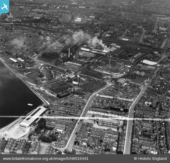
eaw016441 ENGLAND (1948). The McKechnie Bros Ltd Works and environs, Rotton Park, 1948. This image has been produced from a print marked by Aerofilms Ltd for photo editing.
© Copyright OpenStreetMap contributors and licensed by the OpenStreetMap Foundation. 2024. Cartography is licensed as CC BY-SA.
Nearby Images (16)
EAW016441

EAW016444

EAW016442

EAW016443

EAW009975

EPW035925

EPW047137

EPW009721

EAW009968

EPW035928

EPW054219

EPW035927

EPW047129

EAW009967

EAW016445

EAW016439
 and environs, Rotton Park, 1948. This image has been produced from a damaged negative.")
Details
| Title | [EAW016441] The McKechnie Bros Ltd Works and environs, Rotton Park, 1948. This image has been produced from a print marked by Aerofilms Ltd for photo editing. |
| Reference | EAW016441 |
| Date | 9-June-1948 |
| Link | |
| Place name | ROTTON PARK |
| Parish | |
| District | |
| Country | ENGLAND |
| Easting / Northing | 404753, 286975 |
| Longitude / Latitude | -1.9300070661999, 52.480309877821 |
| National Grid Reference | SP048870 |
Pins
Be the first to add a comment to this image!


