
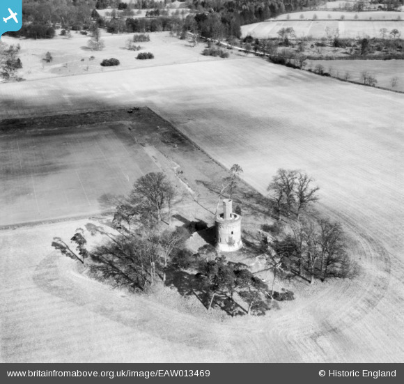
eaw013469 ENGLAND (1948). Bourbon Tower, Stowe Park, 1948
© Copyright OpenStreetMap contributors and licensed by the OpenStreetMap Foundation. 2025. Cartography is licensed as CC BY-SA.
Nearby Images (2)
EAW013469

EAW013468

Details
| Title | [EAW013469] Bourbon Tower, Stowe Park, 1948 |
| Reference | EAW013469 |
| Date | 20-February-1948 |
| Link | |
| Place name | STOWE PARK |
| Parish | STOWE |
| District | |
| Country | ENGLAND |
| Easting / Northing | 468380, 238040 |
| Longitude / Latitude | -1.0030303587262, 52.036121632841 |
| National Grid Reference | SP684380 |
Pins
Be the first to add a comment to this image!