
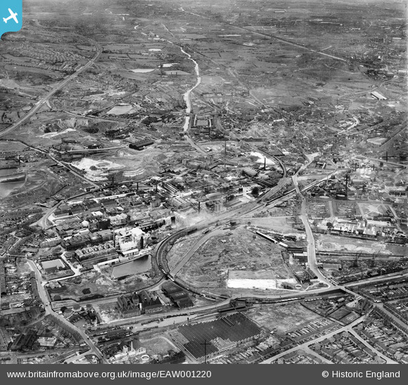
eaw001220 ENGLAND (1946). The Albright and Wilson Chemical Works and the surrounding industrial area, Oldbury, 1946
© Copyright OpenStreetMap contributors and licensed by the OpenStreetMap Foundation. 2025. Cartography is licensed as CC BY-SA.
Nearby Images (3)
EAW001220

EPW010564

EAW001219

Details
| Title | [EAW001220] The Albright and Wilson Chemical Works and the surrounding industrial area, Oldbury, 1946 |
| Reference | EAW001220 |
| Date | 24-June-1946 |
| Link | |
| Place name | OLDBURY |
| Parish | |
| District | |
| Country | ENGLAND |
| Easting / Northing | 399219, 288879 |
| Longitude / Latitude | -2.0115055187786, 52.497448874108 |
| National Grid Reference | SO992889 |
Pins
 Piper |
Friday 3rd of January 2020 11:31:08 AM | |
Sparky |
Friday 17th of November 2017 08:23:54 AM | |
Sparky |
Sunday 24th of September 2017 12:38:52 PM | |
Sparky |
Sunday 24th of September 2017 12:38:15 PM | |
Sparky |
Sunday 24th of September 2017 12:37:39 PM | |
John W |
Thursday 21st of July 2016 06:09:48 PM | |
MikeS |
Sunday 17th of August 2014 12:45:03 PM | |
Martin |
Saturday 28th of December 2013 09:31:53 PM | |
Martin |
Saturday 28th of December 2013 09:30:39 PM |