
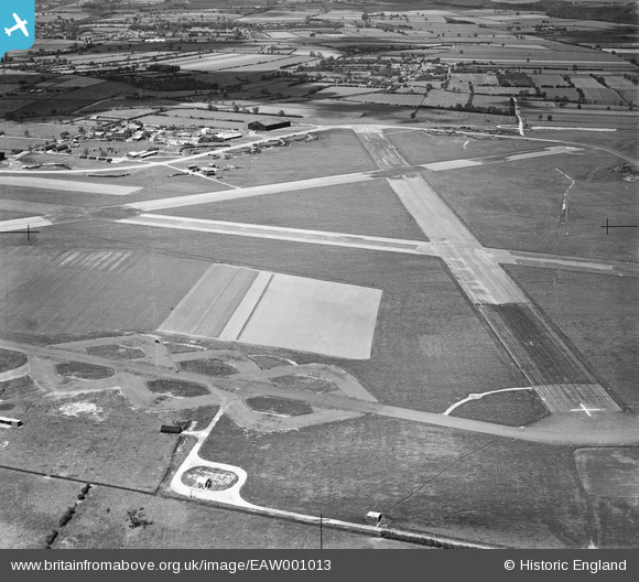
eaw001013 ENGLAND (1946). RAF Wombleton Airfield, Wombleton, 1946
© Copyright OpenStreetMap contributors and licensed by the OpenStreetMap Foundation. 2026. Cartography is licensed as CC BY-SA.
Details
| Title | [EAW001013] RAF Wombleton Airfield, Wombleton, 1946 |
| Reference | EAW001013 |
| Date | 6-June-1946 |
| Link | |
| Place name | WOMBLETON |
| Parish | WOMBLETON |
| District | |
| Country | ENGLAND |
| Easting / Northing | 467281, 482186 |
| Longitude / Latitude | -0.96775069483432, 54.230794392306 |
| National Grid Reference | SE673822 |
Pins
Be the first to add a comment to this image!