
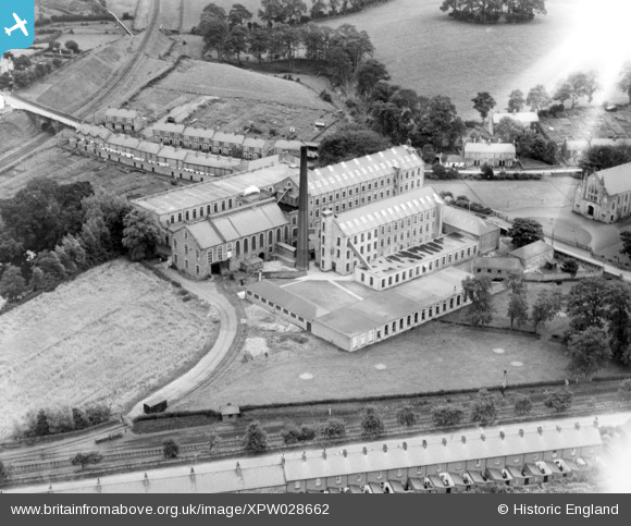
XPW028662 NORTHERN IRELAND (1929). General View, Comber, Ards, Northern Ireland, 1929. Oblique aerial photograph taken facing East.
© Copyright OpenStreetMap contributors and licensed by the OpenStreetMap Foundation. 2025. Cartography is licensed as CC BY-SA.
Nearby Images (2)
XPW028662

XPW028664

Details
| Title | [XPW028662] General View, Comber, Ards, Northern Ireland, 1929. Oblique aerial photograph taken facing East. |
| Reference | XPW028662 |
| Date | 1929 |
| Link | |
| Place name | COMBER |
| Parish | NORTHERN IRELAND |
| District | |
| Country | NORTHERN IRELAND |
| Easting / Northing | 157350, 523535 |
| Longitude / Latitude | -5.753553, 54.548742 |
| National Grid Reference |
Pins
 Buzby |
Sunday 14th of December 2014 10:29:55 AM | |
john little |
Monday 3rd of November 2014 10:14:32 PM | |
john little |
Monday 3rd of November 2014 10:12:41 PM | |
john little |
Monday 3rd of November 2014 10:12:08 PM | |
john little |
Monday 3rd of November 2014 10:09:16 PM | |
john little |
Monday 3rd of November 2014 10:08:29 PM | |
john little |
Monday 3rd of November 2014 10:07:49 PM | |
john little |
Monday 3rd of November 2014 10:07:16 PM | |
john little |
Monday 3rd of November 2014 10:04:45 PM |
User Comment Contributions
Andrews Mill, Comber, operated as a flax spinning mill from 1864 until closure in 1997. It had its own private railway siding connecting it to the Belfast & County Down Railway. |
john little |
Monday 3rd of November 2014 10:26:23 PM |