
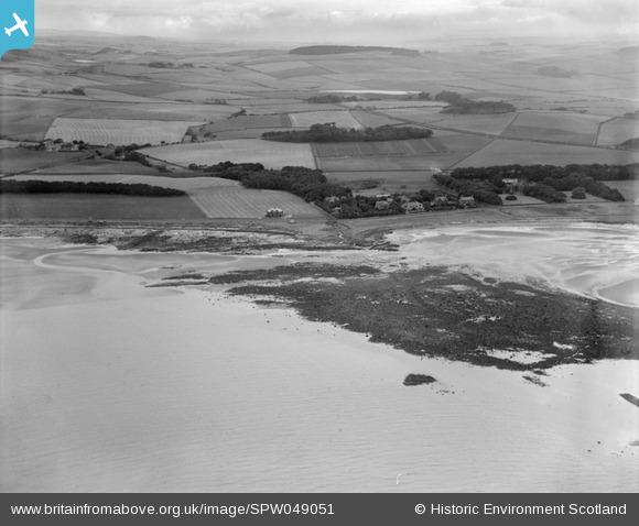
SPW049051 SCOTLAND (1935). Ardrossan, general view, showing Eglinton Road and Burnfoot Bridge. An oblique aerial photograph taken facing north-east.
© Copyright OpenStreetMap contributors and licensed by the OpenStreetMap Foundation. 2025. Cartography is licensed as CC BY-SA.
Nearby Images (2)
SPW049051

SPW049061

Details
| Title | [SPW049051] Ardrossan, general view, showing Eglinton Road and Burnfoot Bridge. An oblique aerial photograph taken facing north-east. |
| Reference | SPW049051 |
| Date | 1935 |
| Link | NRHE Collection item 1257959 |
| Place name | |
| Parish | ARDROSSAN |
| District | CUNNINGHAME |
| Country | SCOTLAND |
| Easting / Northing | 222497, 643367 |
| Longitude / Latitude | -4.8214142121279, 55.651357977769 |
| National Grid Reference | NS225434 |
Pins

Vik |
Monday 14th of October 2019 08:23:35 PM | |
|
Vik |
Monday 14th of October 2019 08:23:01 PM | |
|
Vik |
Monday 14th of October 2019 08:22:02 PM | |
|
Vik |
Monday 14th of October 2019 08:20:27 PM | |
|
Vik |
Monday 14th of October 2019 08:19:37 PM | |
|
Vik |
Monday 14th of October 2019 08:16:52 PM | |
|
Susan M |
Wednesday 3rd of April 2013 05:12:21 PM | |
|
Susan M |
Wednesday 3rd of April 2013 05:11:18 PM | |
|
Susan M |
Wednesday 3rd of April 2013 05:10:31 PM | |
|
Susan M |
Wednesday 3rd of April 2013 05:09:53 PM | |
|
Susan M |
Wednesday 3rd of April 2013 05:09:31 PM |