
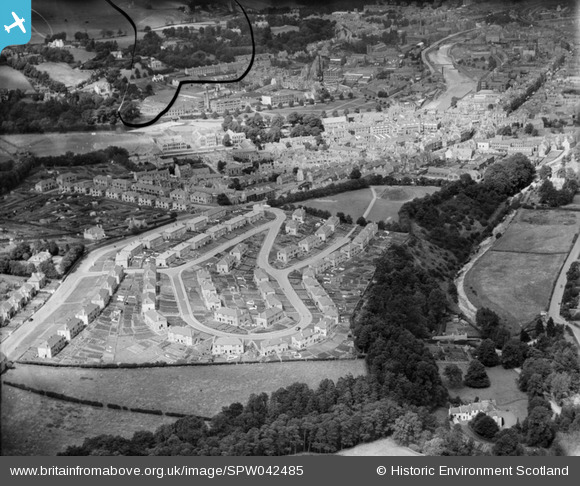
SPW042485 SCOTLAND (1933). Hawick, general view, showing Moar Park and Upper Common Haugh. An oblique aerial photograph taken facing north. This image has been produced from a damaged negative.
© Copyright OpenStreetMap contributors and licensed by the OpenStreetMap Foundation. 2025. Cartography is licensed as CC BY-SA.
Details
| Title | [SPW042485] Hawick, general view, showing Moar Park and Upper Common Haugh. An oblique aerial photograph taken facing north. This image has been produced from a damaged negative. |
| Reference | SPW042485 |
| Date | 1933 |
| Link | NRHE Collection item 1257947 |
| Place name | |
| Parish | HAWICK |
| District | ROXBURGH |
| Country | SCOTLAND |
| Easting / Northing | 349940, 614070 |
| Longitude / Latitude | -2.7908994890578, 55.41796246004 |
| National Grid Reference | NT499141 |
Pins
Be the first to add a comment to this image!