
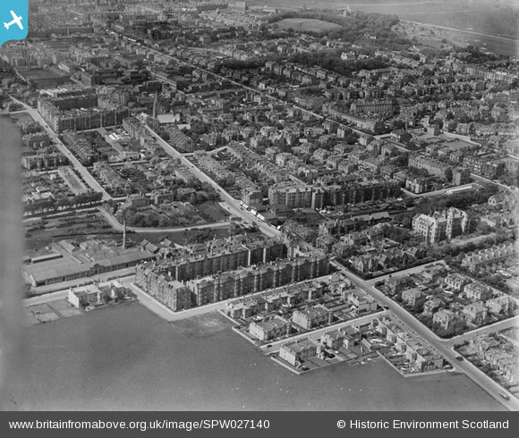
SPW027140 SCOTLAND (1929). Edinburgh, general view, showing Newington and Mayfield Road. An oblique aerial photograph taken facing north.
© Copyright OpenStreetMap contributors and licensed by the OpenStreetMap Foundation. 2025. Cartography is licensed as CC BY-SA.
Nearby Images (2)
SPW027140

SAR029116

Details
| Title | [SPW027140] Edinburgh, general view, showing Newington and Mayfield Road. An oblique aerial photograph taken facing north. |
| Reference | SPW027140 |
| Date | 1929 |
| Link | Canmore Collection item 1256715 |
| Place name | |
| Parish | EDINBURGH (EDINBURGH, CITY OF) |
| District | CITY OF EDINBURGH |
| Country | SCOTLAND |
| Easting / Northing | 326620, 671450 |
| Longitude / Latitude | -3.1746074861727, 55.930548994692 |
| National Grid Reference | NT266715 |
Pins

Andy A |
Thursday 2nd of January 2014 11:56:42 AM | |
|
Andy A |
Thursday 2nd of January 2014 11:54:40 AM | |
|
Andy A |
Thursday 2nd of January 2014 11:53:18 AM | |
|
rmarah |
Thursday 28th of June 2012 03:47:40 PM | |
|
Jim Ross |
Wednesday 27th of June 2012 03:11:35 PM |