
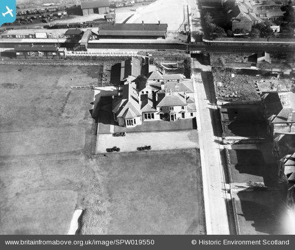
SPW019550 SCOTLAND (1927). Prestwick Golf Course Club House. An oblique aerial photograph taken facing east.
© Copyright OpenStreetMap contributors and licensed by the OpenStreetMap Foundation. 2026. Cartography is licensed as CC BY-SA.
Nearby Images (2)
SPW019549

SPW019550

Details
| Title | [SPW019550] Prestwick Golf Course Club House. An oblique aerial photograph taken facing east. |
| Reference | SPW019550 |
| Date | 1927 |
| Link | NRHE Collection item 1246313 |
| Place name | |
| Parish | MONKTON AND PRESTWICK |
| District | KYLE AND CARRICK |
| Country | SCOTLAND |
| Easting / Northing | 234913, 626198 |
| Longitude / Latitude | -4.6140357319386, 55.501608505168 |
| National Grid Reference | NS349262 |
Pins
Be the first to add a comment to this image!