
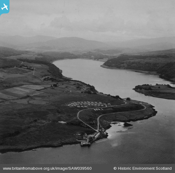
SAW039560 SCOTLAND (1951). Lochaline and Loch Aline. An oblique aerial photograph taken facing north-east. This image has been produced from a print.
© Copyright OpenStreetMap contributors and licensed by the OpenStreetMap Foundation. 2026. Cartography is licensed as CC BY-SA.
Details
| Title | [SAW039560] Lochaline and Loch Aline. An oblique aerial photograph taken facing north-east. This image has been produced from a print. |
| Reference | SAW039560 |
| Date | 1951 |
| Link | NRHE Collection item 1315331 |
| Place name | |
| Parish | MORVERN |
| District | LOCHABER |
| Country | SCOTLAND |
| Easting / Northing | 168220, 745410 |
| Longitude / Latitude | -5.7708427360091, 56.543497548632 |
| National Grid Reference | NM682454 |
Pins

JMB |
Monday 23rd of May 2016 09:07:01 AM | |
|
JMB |
Monday 23rd of May 2016 09:06:49 AM | |
|
JMB |
Monday 23rd of May 2016 09:06:31 AM |