
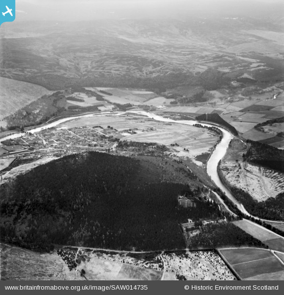
SAW014735 SCOTLAND (1948). Ballater, general view, showing Ballater Golf Course and Craigendarroch. An oblique aerial photograph taken facing south.
© Copyright OpenStreetMap contributors and licensed by the OpenStreetMap Foundation. 2026. Cartography is licensed as CC BY-SA.
Nearby Images (4)
SAW014726

SAW014735

SAW014727

SAW032129

Details
| Title | [SAW014735] Ballater, general view, showing Ballater Golf Course and Craigendarroch. An oblique aerial photograph taken facing south. |
| Reference | SAW014735 |
| Date | 1948 |
| Link | NRHE Collection item 1268861 |
| Place name | |
| Parish | GLENMUICK, TULLICH AND GLENGAIRN |
| District | KINCARDINE AND DEESIDE |
| Country | SCOTLAND |
| Easting / Northing | 336677, 795621 |
| Longitude / Latitude | -3.0438447739163, 57.047479369026 |
| National Grid Reference | NO367956 |
Pins
Be the first to add a comment to this image!