
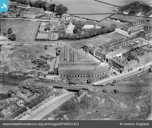
EPW061413 ENGLAND (1939). Denhams Engineering Co Empire Works, Holmfield, 1939
© Copyright OpenStreetMap contributors and licensed by the OpenStreetMap Foundation. 2026. Cartography is licensed as CC BY-SA.
Nearby Images (6)
EPW061413

EPW061416

EPW061418

EPW061415

EPW061417

EPW061414

Details
| Title | [EPW061413] Denhams Engineering Co Empire Works, Holmfield, 1939 |
| Reference | EPW061413 |
| Date | 4-June-1939 |
| Link | |
| Place name | HOLMFIELD |
| Parish | |
| District | |
| Country | ENGLAND |
| Easting / Northing | 408156, 428040 |
| Longitude / Latitude | -1.8763075160243, 53.748447485051 |
| National Grid Reference | SE082280 |
Pins

Rob Daniels |
Saturday 24th of August 2013 03:29:25 PM | |
|
Rob Daniels |
Saturday 24th of August 2013 03:28:56 PM | |
|
Rob Daniels |
Saturday 24th of August 2013 03:28:27 PM |