
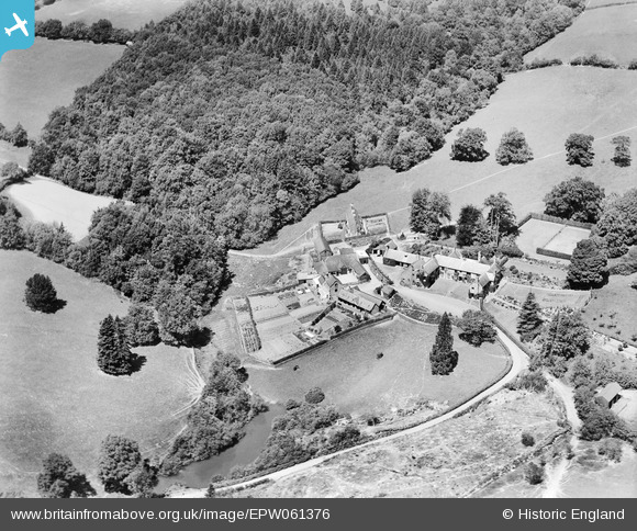
EPW061376 ENGLAND (1939). Combe House, Dulverton, 1939
© Copyright OpenStreetMap contributors and licensed by the OpenStreetMap Foundation. 2026. Cartography is licensed as CC BY-SA.
Nearby Images (4)
EPW061376

EPW061373

EPW061375

EPW061374

Details
| Title | [EPW061376] Combe House, Dulverton, 1939 |
| Reference | EPW061376 |
| Date | 4-June-1939 |
| Link | |
| Place name | DULVERTON |
| Parish | DULVERTON |
| District | |
| Country | ENGLAND |
| Easting / Northing | 291146, 126665 |
| Longitude / Latitude | -3.5524378869069, 51.028493376728 |
| National Grid Reference | SS911267 |
Pins
Be the first to add a comment to this image!