
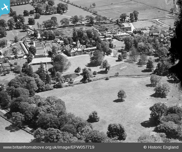
EPW057719 ENGLAND (1938). Turweston House, St Mary's Church and the village centre, Turweston, 1938. This image has been produced from a damaged negative.
© Copyright OpenStreetMap contributors and licensed by the OpenStreetMap Foundation. 2026. Cartography is licensed as CC BY-SA.
Details
| Title | [EPW057719] Turweston House, St Mary's Church and the village centre, Turweston, 1938. This image has been produced from a damaged negative. |
| Reference | EPW057719 |
| Date | 21-June-1938 |
| Link | |
| Place name | TURWESTON |
| Parish | TURWESTON |
| District | |
| Country | ENGLAND |
| Easting / Northing | 459919, 237800 |
| Longitude / Latitude | -1.1264158621497, 52.034942963227 |
| National Grid Reference | SP599378 |
Pins

totoro |
Thursday 7th of November 2013 08:29:56 PM | |
|
totoro |
Thursday 7th of November 2013 08:25:48 PM | |
|
totoro |
Thursday 7th of November 2013 08:21:07 PM |