
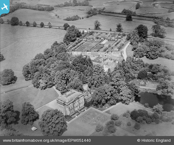
EPW051440 ENGLAND (1936). Cound Hall, Cound, 1936
© Copyright OpenStreetMap contributors and licensed by the OpenStreetMap Foundation. 2026. Cartography is licensed as CC BY-SA.
Nearby Images (4)
EPW051440

EPW051441

EPW051437

EAW012649

Details
| Title | [EPW051440] Cound Hall, Cound, 1936 |
| Reference | EPW051440 |
| Date | August-1936 |
| Link | |
| Place name | COUND |
| Parish | COUND |
| District | |
| Country | ENGLAND |
| Easting / Northing | 356046, 305380 |
| Longitude / Latitude | -2.6496868477893, 52.644026779529 |
| National Grid Reference | SJ560054 |
Pins
Be the first to add a comment to this image!