
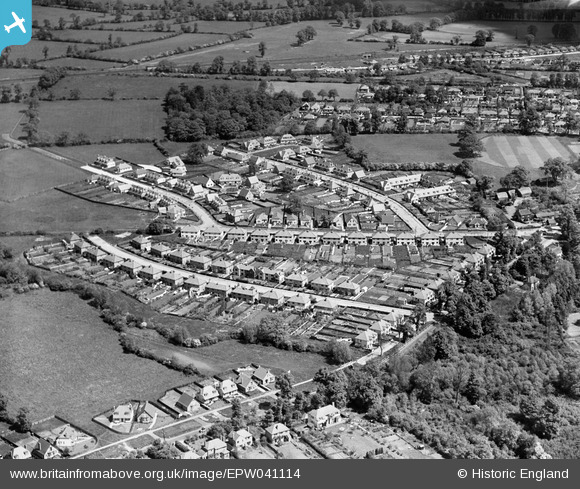
EPW041114 ENGLAND (1933). Housing development at Copthall Road (East), Ickenham, 1933
© Copyright OpenStreetMap contributors and licensed by the OpenStreetMap Foundation. 2025. Cartography is licensed as CC BY-SA.
Nearby Images (2)
EPW041114
, Ickenham, 1933")
EPW041113
, Ickenham, 1933")
Details
| Title | [EPW041114] Housing development at Copthall Road (East), Ickenham, 1933 |
| Reference | EPW041114 |
| Date | May-1933 |
| Link | |
| Place name | ICKENHAM |
| Parish | |
| District | |
| Country | ENGLAND |
| Easting / Northing | 507483, 186498 |
| Longitude / Latitude | -0.4490840423239, 51.566623720427 |
| National Grid Reference | TQ075865 |
Pins
.JPG)
Colin1949 |
Wednesday 5th of March 2014 05:00:12 PM | |

maryjane65 |
Tuesday 15th of October 2013 05:09:59 PM | |
|
maryjane65 |
Tuesday 15th of October 2013 05:09:01 PM | |
|
maryjane65 |
Tuesday 15th of October 2013 05:08:19 PM | |
|
maryjane65 |
Tuesday 15th of October 2013 05:07:21 PM | |
|
maryjane65 |
Tuesday 15th of October 2013 05:06:27 PM | |
|
maryjane65 |
Tuesday 15th of October 2013 05:05:19 PM | |
|
Linda |
Sunday 25th of August 2013 07:42:17 AM |