
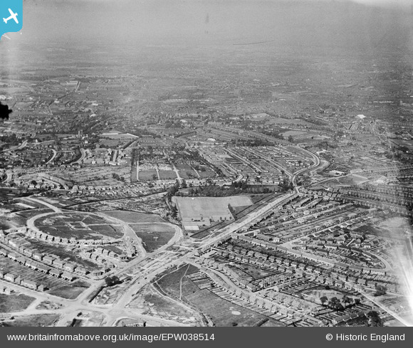
EPW038514 ENGLAND (1932). New housing estates under construction at The Oval and alongside Norman Road and the Uplands Cemetery, Smethwick, from the south-west, 1932
© Copyright OpenStreetMap contributors and licensed by the OpenStreetMap Foundation. 2025. Cartography is licensed as CC BY-SA.
Nearby Images (3)
EPW038514

EPW038513

EPW018364

Details
| Title | [EPW038514] New housing estates under construction at The Oval and alongside Norman Road and the Uplands Cemetery, Smethwick, from the south-west, 1932 |
| Reference | EPW038514 |
| Date | June-1932 |
| Link | |
| Place name | SMETHWICK |
| Parish | |
| District | |
| Country | ENGLAND |
| Easting / Northing | 401163, 286867 |
| Longitude / Latitude | -1.9828739699268, 52.479358312331 |
| National Grid Reference | SP012869 |
Pins
 Kevin |
Saturday 13th of August 2016 01:24:16 AM | |
Phil Uttley |
Friday 26th of September 2014 03:46:51 PM | |
Built in 1732, Smethwick's first church. Next door to the church is the "Old Chapel" pub. Previously called "The Hand of Providence", it was also built in 1732. |
Kevin |
Sunday 24th of July 2016 09:13:50 PM |
Phil Uttley |
Friday 26th of September 2014 03:46:09 PM | |
Phil Uttley |
Friday 26th of September 2014 03:43:42 PM | |
artscotak2 |
Saturday 12th of January 2013 06:44:54 PM |