
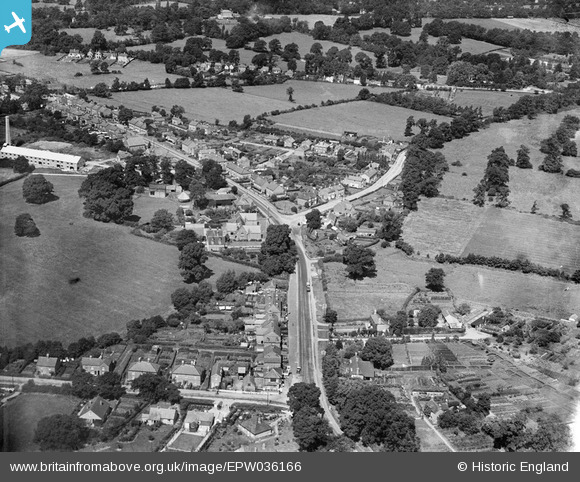
EPW036166 ENGLAND (1931). Bullbrook, Bracknell, 1931
© Copyright OpenStreetMap contributors and licensed by the OpenStreetMap Foundation. 2025. Cartography is licensed as CC BY-SA.
Details
| Title | [EPW036166] Bullbrook, Bracknell, 1931 |
| Reference | EPW036166 |
| Date | August-1931 |
| Link | |
| Place name | BRACKNELL |
| Parish | BRACKNELL |
| District | |
| Country | ENGLAND |
| Easting / Northing | 488131, 169216 |
| Longitude / Latitude | -0.73255625187352, 51.414610751833 |
| National Grid Reference | SU881692 |
Pins
 Ian |
Wednesday 1st of May 2024 04:48:50 PM | |
Ian |
Wednesday 1st of May 2024 04:47:42 PM | |
Ian |
Wednesday 1st of May 2024 04:47:23 PM | |
Ian |
Wednesday 1st of May 2024 04:30:51 PM | |
Ian |
Wednesday 1st of May 2024 04:26:25 PM | |
Ian |
Wednesday 1st of May 2024 04:25:35 PM | |
Ian |
Wednesday 1st of May 2024 04:24:10 PM | |
Ian |
Wednesday 1st of May 2024 04:23:49 PM | |
Ian |
Wednesday 1st of May 2024 04:22:35 PM | |
Ian |
Wednesday 1st of May 2024 04:20:21 PM | |
John41ish |
Sunday 28th of March 2021 12:25:50 AM | |
Guapito |
Thursday 25th of January 2018 10:38:33 PM | |
Guapito |
Thursday 25th of January 2018 10:37:41 PM | |
Guapito |
Thursday 25th of January 2018 10:35:15 PM | |
Nemesis |
Thursday 16th of July 2015 03:33:10 PM | |
Nemesis |
Thursday 16th of July 2015 03:30:41 PM |