
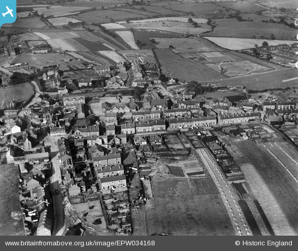
EPW034168 ENGLAND (1930). The village and surrounding countryside, Ryhill, 1930
© Copyright OpenStreetMap contributors and licensed by the OpenStreetMap Foundation. 2025. Cartography is licensed as CC BY-SA.
Nearby Images (3)
EPW034168

EPW034167

EPW034169

Details
| Title | [EPW034168] The village and surrounding countryside, Ryhill, 1930 |
| Reference | EPW034168 |
| Date | July-1930 |
| Link | |
| Place name | RYHILL |
| Parish | RYHILL |
| District | |
| Country | ENGLAND |
| Easting / Northing | 438538, 414290 |
| Longitude / Latitude | -1.4172642259375, 53.623491639649 |
| National Grid Reference | SE385143 |
Pins

Big_Bob |
Wednesday 31st of January 2024 12:54:57 AM | |
|
Big_Bob |
Wednesday 31st of January 2024 12:22:10 AM | |
|
Big_Bob |
Wednesday 31st of January 2024 12:20:37 AM | |
|
Big_Bob |
Wednesday 31st of January 2024 12:19:54 AM | |
|
Big_Bob |
Wednesday 31st of January 2024 12:19:33 AM | |
|
Big_Bob |
Saturday 25th of February 2023 12:26:25 AM | |
|
Big_Bob |
Saturday 25th of February 2023 12:25:56 AM | |
|
Big_Bob |
Saturday 25th of February 2023 12:23:56 AM | |
|
Big_Bob |
Saturday 25th of February 2023 12:22:03 AM |