
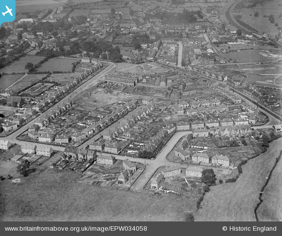
EPW034058 ENGLAND (1930). New housing and housing under construction around Harrison Road, Cannock, 1930
© Copyright OpenStreetMap contributors and licensed by the OpenStreetMap Foundation. 2025. Cartography is licensed as CC BY-SA.
Details
| Title | [EPW034058] New housing and housing under construction around Harrison Road, Cannock, 1930 |
| Reference | EPW034058 |
| Date | July-1930 |
| Link | |
| Place name | CANNOCK |
| Parish | |
| District | |
| Country | ENGLAND |
| Easting / Northing | 398205, 309508 |
| Longitude / Latitude | -2.0265554210367, 52.682918495518 |
| National Grid Reference | SJ982095 |
Pins
Be the first to add a comment to this image!