
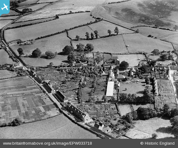
EPW033718 ENGLAND (1930). Boyd's Hair Factory and environs, Castle Cary, 1930
© Copyright OpenStreetMap contributors and licensed by the OpenStreetMap Foundation. 2025. Cartography is licensed as CC BY-SA.
Details
| Title | [EPW033718] Boyd's Hair Factory and environs, Castle Cary, 1930 |
| Reference | EPW033718 |
| Date | July-1930 |
| Link | |
| Place name | CASTLE CARY |
| Parish | CASTLE CARY |
| District | |
| Country | ENGLAND |
| Easting / Northing | 364391, 132458 |
| Longitude / Latitude | -2.5085027213491, 51.089797156129 |
| National Grid Reference | ST644325 |
Pins
 Caryroger |
Thursday 27th of February 2020 12:43:05 PM | |
 Class31 |
Friday 22nd of March 2013 08:52:34 PM | |
Class31 |
Friday 22nd of March 2013 08:48:36 PM | |
Class31 |
Friday 22nd of March 2013 08:46:51 PM | |
Class31 |
Friday 22nd of March 2013 08:42:15 PM | |
Class31 |
Friday 22nd of March 2013 08:41:29 PM | |
Class31 |
Friday 22nd of March 2013 08:39:41 PM |
User Comment Contributions
View looking south. |
Class31 |
Friday 22nd of March 2013 08:50:25 PM |