
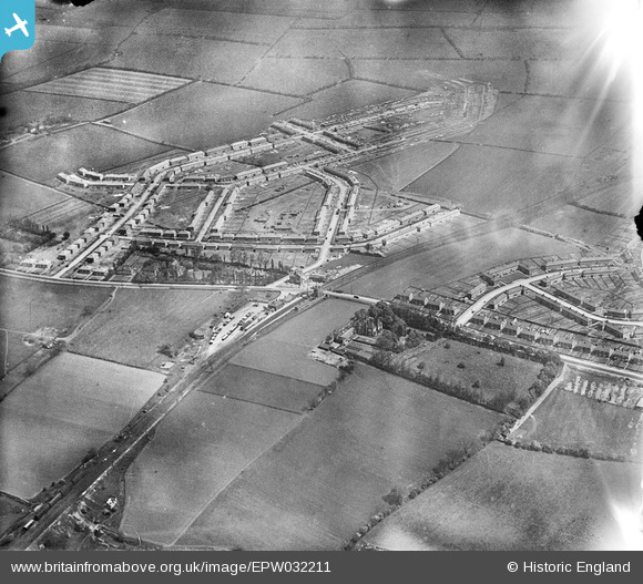
EPW032211 ENGLAND (1930). Cheviot Crescent and environs, Billingham, 1930
© Copyright OpenStreetMap contributors and licensed by the OpenStreetMap Foundation. 2025. Cartography is licensed as CC BY-SA.
Details
| Title | [EPW032211] Cheviot Crescent and environs, Billingham, 1930 |
| Reference | EPW032211 |
| Date | May-1930 |
| Link | |
| Place name | BILLINGHAM |
| Parish | BILLINGHAM |
| District | |
| Country | ENGLAND |
| Easting / Northing | 445499, 523302 |
| Longitude / Latitude | -1.2955965809398, 54.602719469442 |
| National Grid Reference | NZ455233 |
Pins
 Fantasma |
Wednesday 19th of February 2014 08:44:03 AM | |
martin jamieson |
Thursday 17th of January 2013 06:30:53 PM | |
 Class31 |
Wednesday 7th of November 2012 03:43:28 PM | |
Class31 |
Wednesday 7th of November 2012 03:43:06 PM | |
Class31 |
Wednesday 7th of November 2012 03:42:36 PM | |
Class31 |
Wednesday 7th of November 2012 03:42:11 PM | |
Class31 |
Wednesday 7th of November 2012 03:41:53 PM | |
Class31 |
Wednesday 7th of November 2012 03:41:13 PM | |
Class31 |
Wednesday 7th of November 2012 03:40:43 PM | |
Class31 |
Wednesday 7th of November 2012 03:39:56 PM | |
Class31 |
Wednesday 7th of November 2012 03:39:37 PM | |
Class31 |
Wednesday 7th of November 2012 03:38:41 PM |