
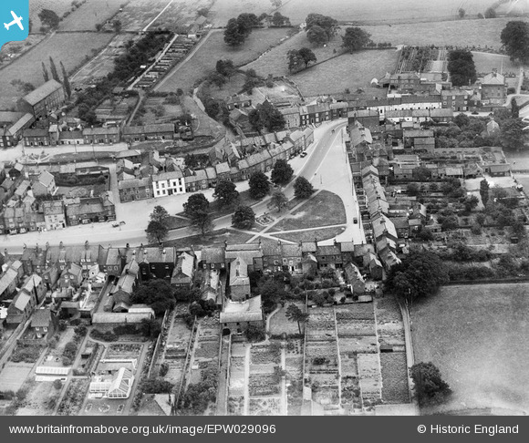
EPW029096 ENGLAND (1929). West Green (formerly Low Green), Stokesley, 1929
© Copyright OpenStreetMap contributors and licensed by the OpenStreetMap Foundation. 2025. Cartography is licensed as CC BY-SA.
Nearby Images (3)
EPW029096
, Stokesley, 1929")
EPW029095

EPW029099

Details
| Title | [EPW029096] West Green (formerly Low Green), Stokesley, 1929 |
| Reference | EPW029096 |
| Date | September-1929 |
| Link | |
| Place name | STOKESLEY |
| Parish | STOKESLEY |
| District | |
| Country | ENGLAND |
| Easting / Northing | 452225, 508470 |
| Longitude / Latitude | -1.1941076330465, 54.468773453843 |
| National Grid Reference | NZ522085 |
Pins
User Comment Contributions
View looking south. |

Class31 |
Sunday 21st of October 2012 06:11:15 PM |