
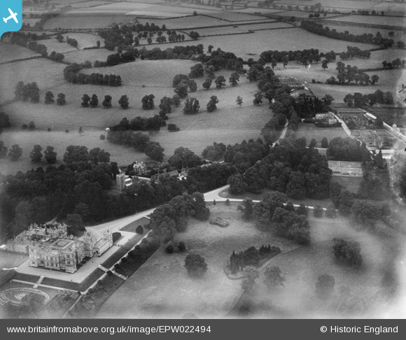
EPW022494 ENGLAND (1928). Mentmore Towers and St Mary's Church, Mentmore, 1928
© Copyright OpenStreetMap contributors and licensed by the OpenStreetMap Foundation. 2025. Cartography is licensed as CC BY-SA.
Nearby Images (8)
EPW022494

EAW048769

EPW022495

EAW048771

EAW048772

EPW022493

EAW048770

EPW022492

Details
| Title | [EPW022494] Mentmore Towers and St Mary's Church, Mentmore, 1928 |
| Reference | EPW022494 |
| Date | August-1928 |
| Link | |
| Place name | MENTMORE |
| Parish | MENTMORE |
| District | |
| Country | ENGLAND |
| Easting / Northing | 490472, 219858 |
| Longitude / Latitude | -0.68580094730113, 51.869510737269 |
| National Grid Reference | SP905199 |
Pins
Be the first to add a comment to this image!