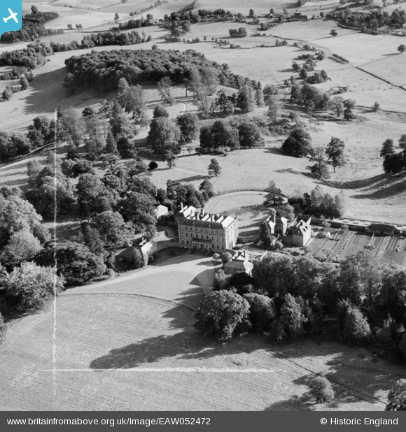
© Copyright OpenStreetMap contributors and licensed by the OpenStreetMap Foundation. 2025. Cartography is licensed as CC BY-SA.
Details
| Title |
[EAW052472] Davenport House and Gardens, Worfield, 1953. This image was marked by Aerofilms Ltd for photo editing. |
| Reference |
EAW052472 |
| Date |
12-September-1953 |
| Link |
|
| Place name |
WORFIELD |
| Parish |
WORFIELD |
| District |
|
| Country |
ENGLAND |
| Easting / Northing |
375367, 295400 |
| Longitude / Latitude |
-2.363367448916, 52.555521752297 |
| National Grid Reference |
SO754954 |
Pins
  Davenport House, Worfield Shropshire WV15 5LE
Grade 1 listed building - English Heritage Building ID: 255011
includes stables, coach house, lodge, laundry and wall, which are protected by Grade I Listing.
1726. Architect, Smith of Warwick. A Georgian mansion in a landscaped park, built for Henry Davenport, who had made his fortune in India. He died in 1731. Consists of a rectangular centre block with four detached office wings connected by curved screen walls.
Currently a "venue" used for events.
Development of the adjoining park and grounds was probably undertaken by Sharington Davenport, starting in 1731. Many features in the garden date from the mid-18th century, when most of the improvements were being carried out.
Parks and Gardens Data Services Record Id: 1054
The circular pond on the South side is original. The park descends to the River Worfe where a dingle garden was created, containing a ruined temple, a grotto and a small Gothic building.
There is a tower like dovecote in the North East corner of the park, mid 18th C.
Image- thought to be about 1945- from "janes" via www.sharehistory.org (Share Our Past Ltd) is licenced under Creative Commons Attribution NonCommercial licence (CC-BY-NC) (http://creativecommons.org/licenses/by-nc/3.0/) |
totoro |
Monday 1st of December 2014 07:06:49 PM |