
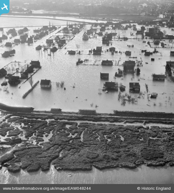
EAW048244 ENGLAND (1953). Flooding at Sunken Marsh around Strasbourg Road and Brandenburg Road, Canvey Island, 1953
© Copyright OpenStreetMap contributors and licensed by the OpenStreetMap Foundation. 2025. Cartography is licensed as CC BY-SA.
Nearby Images (3)
EAW048244

EAW048250

EAW048241

Details
| Title | [EAW048244] Flooding at Sunken Marsh around Strasbourg Road and Brandenburg Road, Canvey Island, 1953 |
| Reference | EAW048244 |
| Date | 2-February-1953 |
| Link | |
| Place name | CANVEY ISLAND |
| Parish | CANVEY ISLAND |
| District | |
| Country | ENGLAND |
| Easting / Northing | 580645, 184351 |
| Longitude / Latitude | 0.60456124375837, 51.528649302942 |
| National Grid Reference | TQ806844 |
Pins
Be the first to add a comment to this image!