
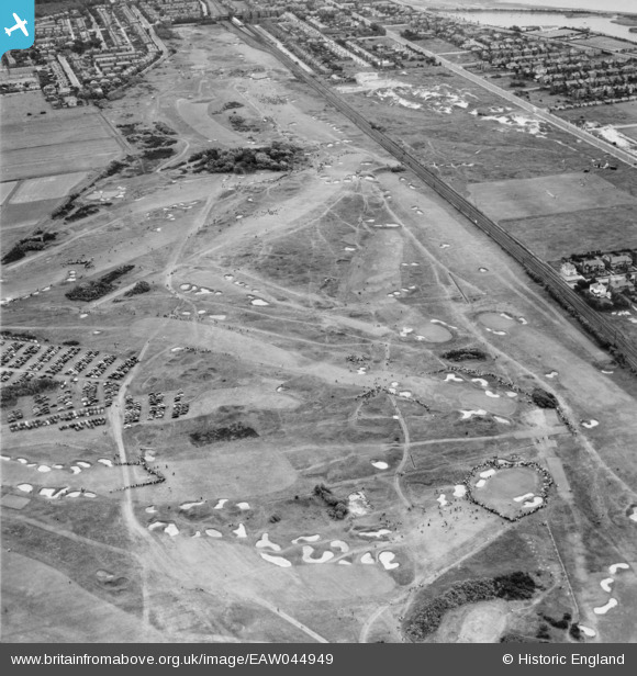
EAW044949 ENGLAND (1952). Lytham St Anne's, the 1952 Open Golf Championship (9-11 July) in progress at Royal Lytham St Anne's Golf Course, 1952
© Copyright OpenStreetMap contributors and licensed by the OpenStreetMap Foundation. 2026. Cartography is licensed as CC BY-SA.
Details
| Title | [EAW044949] Lytham St Anne's, the 1952 Open Golf Championship (9-11 July) in progress at Royal Lytham St Anne's Golf Course, 1952 |
| Reference | EAW044949 |
| Date | July-1952 |
| Link | |
| Place name | LYTHAM ST ANNE'S |
| Parish | SAINT ANNE'S ON THE SEA |
| District | |
| Country | ENGLAND |
| Easting / Northing | 333662, 428277 |
| Longitude / Latitude | -3.0060374476336, 53.746419766595 |
| National Grid Reference | SD337283 |
Pins

redmist |
Thursday 11th of February 2021 11:55:30 AM | |
|
redmist |
Thursday 11th of February 2021 11:54:27 AM | |
|
redmist |
Thursday 11th of February 2021 11:53:23 AM | |
|
redmist |
Thursday 11th of February 2021 11:52:44 AM |