
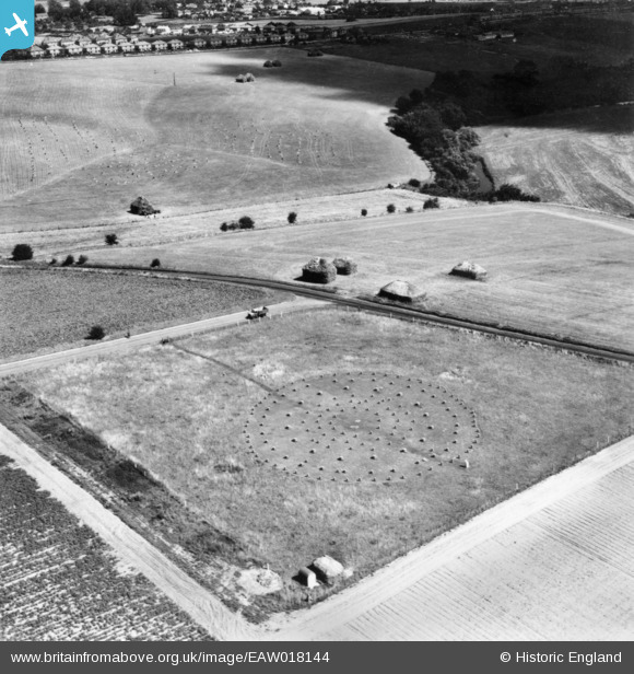
EAW018144 ENGLAND (1948). Woodhenge, Durrington, 1948. This image has been produced from a print.
© Copyright OpenStreetMap contributors and licensed by the OpenStreetMap Foundation. 2025. Cartography is licensed as CC BY-SA.
Nearby Images (4)
EAW018144

EAW018143

EAW018145

EAW018146

Details
| Title | [EAW018144] Woodhenge, Durrington, 1948. This image has been produced from a print. |
| Reference | EAW018144 |
| Date | 16-August-1948 |
| Link | |
| Place name | DURRINGTON |
| Parish | DURRINGTON |
| District | |
| Country | ENGLAND |
| Easting / Northing | 415081, 143420 |
| Longitude / Latitude | -1.784177807613, 51.189285830341 |
| National Grid Reference | SU151434 |
Pins
Be the first to add a comment to this image!