
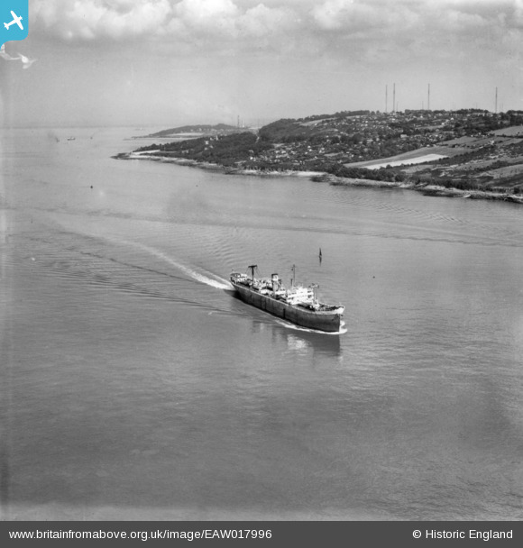
EAW017996 ENGLAND (1948). The SS Tower Grange under way in the Bristol Channel, Portishead, from the north-west, 1948. This image has been produced from a print.
© Copyright OpenStreetMap contributors and licensed by the OpenStreetMap Foundation. 2025. Cartography is licensed as CC BY-SA.
Nearby Images (2)
EAW017996

EAW017995

Details
| Title | [EAW017996] The SS Tower Grange under way in the Bristol Channel, Portishead, from the north-west, 1948. This image has been produced from a print. |
| Reference | EAW017996 |
| Date | 10-August-1948 |
| Link | |
| Place name | PORTISHEAD |
| Parish | |
| District | |
| Country | ENGLAND |
| Easting / Northing | 343512, 176032 |
| Longitude / Latitude | -2.8135257787528, 51.479935141319 |
| National Grid Reference | ST435760 |
Pins
 nkingdon |
Sunday 26th of October 2014 11:07:12 PM | |
nkingdon |
Sunday 26th of October 2014 10:55:07 PM | |
nkingdon |
Sunday 26th of October 2014 10:54:40 PM | |
nkingdon |
Sunday 26th of October 2014 10:51:12 PM |