
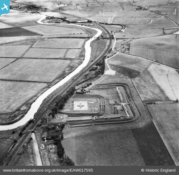
EAW017595 ENGLAND (1948). Richborough Roman Fort, Ash, 1948. This image has been produced from a print.
© Copyright OpenStreetMap contributors and licensed by the OpenStreetMap Foundation. 2025. Cartography is licensed as CC BY-SA.
Nearby Images (5)
EAW017595

EAW017596

EAW017593

EAW017594

EAW017597

Details
| Title | [EAW017595] Richborough Roman Fort, Ash, 1948. This image has been produced from a print. |
| Reference | EAW017595 |
| Date | 22-July-1948 |
| Link | |
| Place name | ASH |
| Parish | ASH |
| District | |
| Country | ENGLAND |
| Easting / Northing | 632403, 160080 |
| Longitude / Latitude | 1.3336990814438, 51.291836660967 |
| National Grid Reference | TR324601 |
Pins
Be the first to add a comment to this image!