
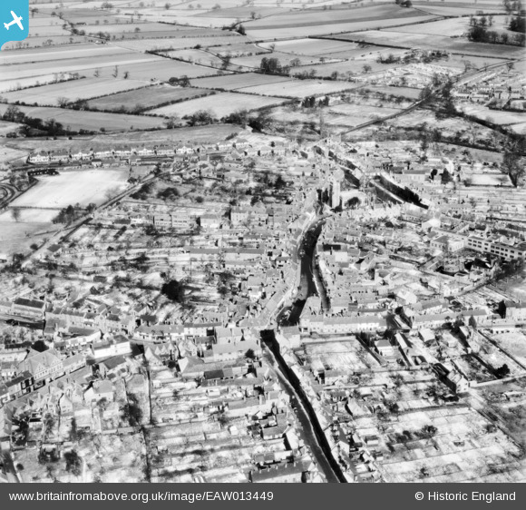
EAW013449 ENGLAND (1948). The town centre, Alcester, 1948
© Copyright OpenStreetMap contributors and licensed by the OpenStreetMap Foundation. 2026. Cartography is licensed as CC BY-SA.
Details
| Title | [EAW013449] The town centre, Alcester, 1948 |
| Reference | EAW013449 |
| Date | 20-February-1948 |
| Link | |
| Place name | ALCESTER |
| Parish | ALCESTER |
| District | |
| Country | ENGLAND |
| Easting / Northing | 408966, 257426 |
| Longitude / Latitude | -1.8687554948444, 52.214576354792 |
| National Grid Reference | SP090574 |
Pins

tony |
Saturday 7th of March 2015 08:25:00 PM | |
|
tony |
Saturday 7th of March 2015 08:23:43 PM | |

Class31 |
Sunday 31st of August 2014 09:30:38 PM | |
|
Class31 |
Sunday 31st of August 2014 09:28:41 PM | |
|
Class31 |
Sunday 31st of August 2014 09:27:15 PM | |
|
Class31 |
Sunday 31st of August 2014 09:26:44 PM | |
|
Class31 |
Sunday 31st of August 2014 09:20:24 PM | |
|
Class31 |
Sunday 31st of August 2014 09:16:03 PM | |

clippedwings |
Wednesday 5th of February 2014 09:34:02 PM | |
|
clippedwings |
Wednesday 5th of February 2014 09:30:27 PM |


