
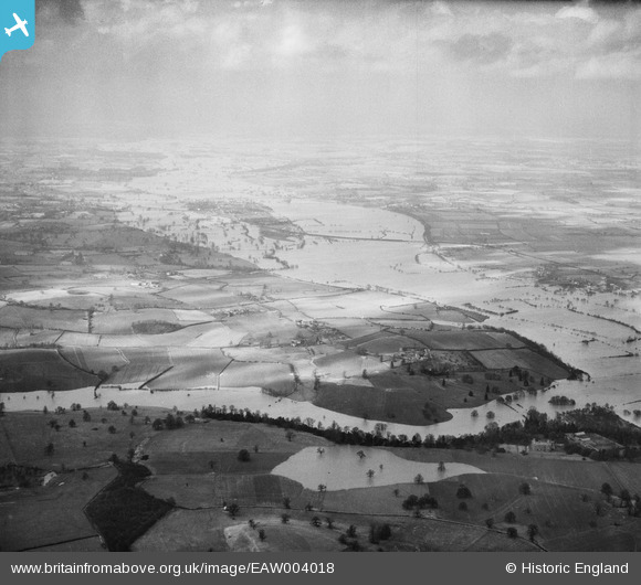
EAW004018 ENGLAND (1947). Flooding along the River Severn and Bushley Brook, Queenhill, from the south, 1947
© Copyright OpenStreetMap contributors and licensed by the OpenStreetMap Foundation. 2026. Cartography is licensed as CC BY-SA.
Details
| Title | [EAW004018] Flooding along the River Severn and Bushley Brook, Queenhill, from the south, 1947 |
| Reference | EAW004018 |
| Date | 21-March-1947 |
| Link | |
| Place name | QUEENHILL |
| Parish | QUEENHILL |
| District | |
| Country | ENGLAND |
| Easting / Northing | 385823, 236852 |
| Longitude / Latitude | -2.206665368884, 52.029475863325 |
| National Grid Reference | SO858369 |
Pins

John G. |
Friday 13th of February 2015 04:28:54 PM | |
|
John G. |
Friday 13th of February 2015 04:26:59 PM | |
 |
John G. |
Friday 13th of February 2015 04:24:07 PM |
|
John G. |
Friday 13th of February 2015 04:16:54 PM | |
 |
John G. |
Friday 13th of February 2015 04:15:24 PM |