
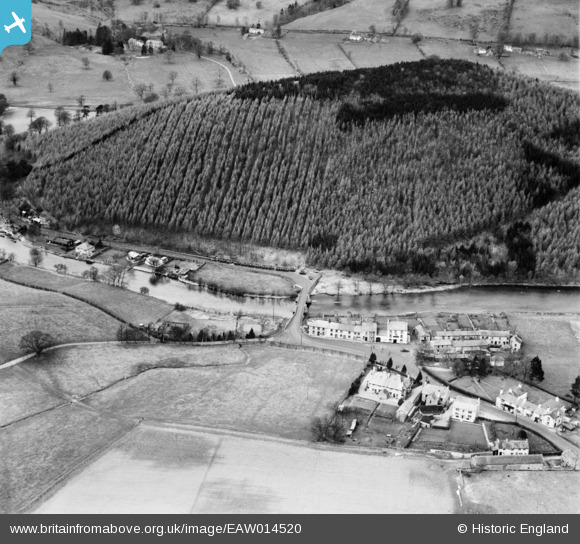
eaw014520 ENGLAND (1948). Dunmallard Hill and Pooley Bridge, Soulby, 1948
© Copyright OpenStreetMap contributors and licensed by the OpenStreetMap Foundation. 2025. Cartography is licensed as CC BY-SA.
Nearby Images (3)
EAW014520

EAW014519

EAW014521

Details
| Title | [EAW014520] Dunmallard Hill and Pooley Bridge, Soulby, 1948 |
| Reference | EAW014520 |
| Date | 14-April-1948 |
| Link | |
| Place name | SOULBY |
| Parish | DACRE |
| District | |
| Country | ENGLAND |
| Easting / Northing | 346926, 524442 |
| Longitude / Latitude | -2.8218714911869, 54.612225443153 |
| National Grid Reference | NY469244 |
Pins
 aiwacat |
Wednesday 19th of February 2020 12:49:26 PM |