
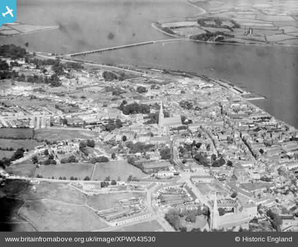
XPW043530 IRELAND (1933). General View, Wexford, Wexford, Ireland, 1933. Oblique aerial photograph taken facing North.
© Copyright OpenStreetMap contributors and licensed by the OpenStreetMap Foundation. 2026. Cartography is licensed as CC BY-SA.
Details
| Title | [XPW043530] General View, Wexford, Wexford, Ireland, 1933. Oblique aerial photograph taken facing North. |
| Reference | XPW043530 |
| Date | 1933 |
| Link | |
| Place name | WEXFORD |
| Parish | IRELAND |
| District | |
| Country | IRELAND |
| Easting / Northing | 95909, 280835 |
| Longitude / Latitude | -6.465981, 52.341053 |
| National Grid Reference |
Pins

Diarmuid Sinnott |
Thursday 23rd of October 2014 02:26:59 PM | |

John Swain |
Wednesday 8th of October 2014 01:53:54 PM | |
|
John Swain |
Wednesday 8th of October 2014 12:35:14 PM | |
|
John Swain |
Wednesday 8th of October 2014 12:28:01 PM | |
|
John Swain |
Wednesday 8th of October 2014 12:21:08 PM | |
|
John Swain |
Wednesday 8th of October 2014 12:16:29 PM | |
|
John Swain |
Wednesday 8th of October 2014 12:12:45 PM | |
|
John Swain |
Wednesday 8th of October 2014 12:10:34 PM | |
|
John Swain |
Wednesday 8th of October 2014 12:07:26 PM | |
|
John Swain |
Wednesday 8th of October 2014 12:01:45 PM | |
|
John Swain |
Wednesday 8th of October 2014 11:57:18 AM | |
|
John Swain |
Wednesday 8th of October 2014 11:53:21 AM |
User Comment Contributions

Wexford Station, formerly North, until renamed O'Hanrahan Station in 1966. "Sea Breeze" excursion train No.4, 2-6-4(T) has just pulled into the platform at 2.09 pm on Sunday, July 29th, 2007, before continuing the final leg of its journey to Rosslare. |
John Swain |
Monday 13th of October 2014 01:57:11 PM |