
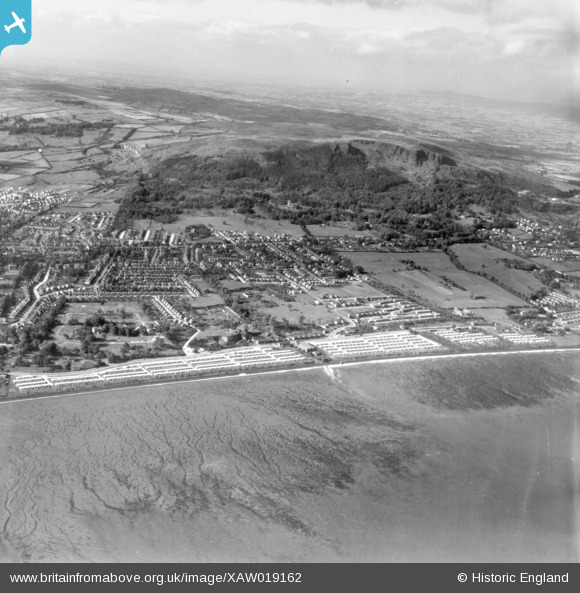
XAW019162 NORTHERN IRELAND (1948). Pre-Fabs, Belfast, Belfast, Northern Ireland, 1948. Oblique aerial photograph taken facing West.
© Copyright OpenStreetMap contributors and licensed by the OpenStreetMap Foundation. 2026. Cartography is licensed as CC BY-SA.
Details
| Title | [XAW019162] Pre-Fabs, Belfast, Belfast, Northern Ireland, 1948. Oblique aerial photograph taken facing West. |
| Reference | XAW019162 |
| Date | 25-October-1948 |
| Link | |
| Place name | BELFAST |
| Parish | NORTHERN IRELAND |
| District | |
| Country | NORTHERN IRELAND |
| Easting / Northing | 146722, 533813 |
| Longitude / Latitude | -5.926342, 54.63568 |
| National Grid Reference |
Pins

Ruther18 |
Friday 30th of January 2026 10:57:10 PM | |
|
Jk |
Friday 9th of February 2024 04:48:22 PM | |
|
Jk |
Friday 9th of February 2024 04:47:30 PM | |
|
Jk |
Friday 9th of February 2024 04:43:28 PM | |
|
bobby2shoes |
Friday 3rd of September 2021 01:26:54 PM | |
|
Brendan |
Thursday 13th of July 2017 12:04:02 AM | |
|
TonyMc |
Friday 31st of October 2014 12:59:34 PM | |
|
TonyMc |
Friday 31st of October 2014 12:45:03 PM |