
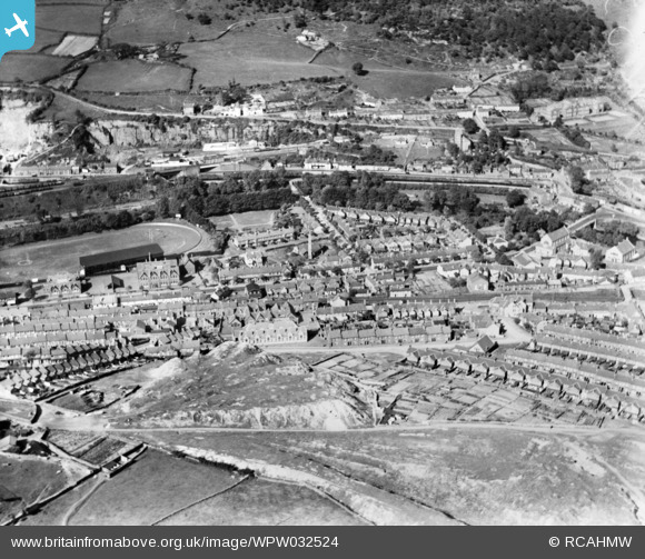
WPW032524 WALES (1930). General view of Pontypridd, showing Taff Vale Park, oblique aerial view. 5"x4" black and white glass plate negative.
© Copyright OpenStreetMap contributors and licensed by the OpenStreetMap Foundation. 2026. Cartography is licensed as CC BY-SA.
Details
| Title | [WPW032524] General view of Pontypridd, showing Taff Vale Park, oblique aerial view. 5"x4" black and white glass plate negative. |
| Reference | WPW032524 |
| Date | 1930 |
| Link | Coflein Archive Item 6370808 |
| Place name | |
| Parish | |
| District | |
| Country | WALES |
| Easting / Northing | 308114, 189572 |
| Longitude / Latitude | -3.3267355677715, 51.597016853403 |
| National Grid Reference | ST081896 |
Pins

redzep66 |
Thursday 25th of March 2021 08:10:46 PM | |
|
redzep66 |
Thursday 25th of March 2021 08:09:35 PM | |
|
Stephen Rowson |
Thursday 3rd of August 2017 10:00:38 AM | |
|
ddraigcelt |
Saturday 6th of August 2016 08:24:18 AM | |

Cwm458 |
Thursday 7th of August 2014 12:49:49 PM | |

Dougywales |
Sunday 7th of April 2013 12:11:30 PM | |
|
dsl86 |
Friday 29th of June 2012 08:57:58 PM | |
|
Chelsea61 |
Friday 29th of June 2012 12:19:51 AM | |
|
Chelsea61 |
Friday 29th of June 2012 12:18:43 AM | |
|
Chelsea61 |
Friday 29th of June 2012 12:17:56 AM | |
|
Chelsea61 |
Friday 29th of June 2012 12:16:20 AM |
User Comment Contributions
View of Treforest and Glyntaff |
Chelsea61 |
Friday 29th of June 2012 12:21:01 AM |