
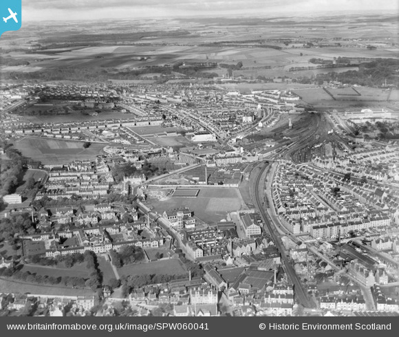
SPW060041 SCOTLAND (1938). Aberdeen, general view, showing Royal Cornhill Hospital, Berryden Road and Clifton Road. An oblique aerial photograph taken facing north.
© Copyright OpenStreetMap contributors and licensed by the OpenStreetMap Foundation. 2026. Cartography is licensed as CC BY-SA.
Details
| Title | [SPW060041] Aberdeen, general view, showing Royal Cornhill Hospital, Berryden Road and Clifton Road. An oblique aerial photograph taken facing north. |
| Reference | SPW060041 |
| Date | 1938 |
| Link | NRHE Collection item 1258279 |
| Place name | |
| Parish | ABERDEEN |
| District | CITY OF ABERDEEN |
| Country | SCOTLAND |
| Easting / Northing | 393110, 807590 |
| Longitude / Latitude | -2.1139178612478, 57.159307693716 |
| National Grid Reference | NJ931076 |
Pins

zacwill |
Wednesday 4th of October 2023 03:01:43 PM | |
|
DonsideGeek |
Sunday 6th of January 2019 11:10:35 AM | |
|
DonsideGeek |
Sunday 6th of January 2019 11:06:31 AM | |
|
toonserjim |
Wednesday 12th of February 2014 09:09:57 PM | |

Class31 |
Monday 12th of November 2012 12:42:47 PM | |
|
Class31 |
Monday 12th of November 2012 12:41:47 PM | |
|
Class31 |
Monday 12th of November 2012 12:41:14 PM | |
|
Class31 |
Monday 12th of November 2012 12:40:46 PM | |
|
Class31 |
Monday 12th of November 2012 12:40:16 PM |