
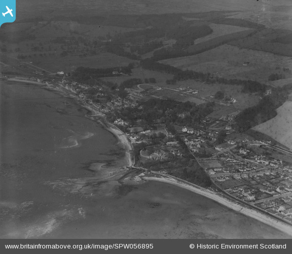
SPW056895 SCOTLAND (1938). Fairlie, general view, showing Fairlie House and Main Road. An oblique aerial photograph taken facing north-east.
© Copyright OpenStreetMap contributors and licensed by the OpenStreetMap Foundation. 2025. Cartography is licensed as CC BY-SA.
Details
| Title | [SPW056895] Fairlie, general view, showing Fairlie House and Main Road. An oblique aerial photograph taken facing north-east. |
| Reference | SPW056895 |
| Date | 1938 |
| Link | NRHE Collection item 1258246 |
| Place name | |
| Parish | LARGS |
| District | CUNNINGHAME |
| Country | SCOTLAND |
| Easting / Northing | 220857, 654953 |
| Longitude / Latitude | -4.8550227767008, 55.754741235851 |
| National Grid Reference | NS209550 |
Pins

thomasmann |
Friday 21st of June 2013 01:32:40 PM | |
|
thomasmann |
Friday 21st of June 2013 01:31:11 PM | |
|
thomasmann |
Wednesday 14th of November 2012 05:39:15 PM |