
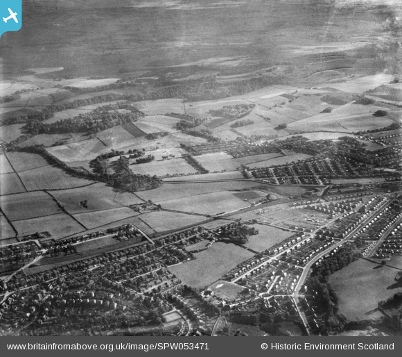
SPW053471 SCOTLAND (1937). General view, Burnside, Rutherglen, Lanarkshire, Scotland, 1937. An oblique aerial photograph, taken facing south-west.
© Copyright OpenStreetMap contributors and licensed by the OpenStreetMap Foundation. 2026. Cartography is licensed as CC BY-SA.
Details
| Title | [SPW053471] General view, Burnside, Rutherglen, Lanarkshire, Scotland, 1937. An oblique aerial photograph, taken facing south-west. |
| Reference | SPW053471 |
| Date | 1937 |
| Link | NRHE Collection item 1452105 |
| Place name | |
| Parish | CAMBUSLANG (CITY OF GLASGOW) |
| District | CITY OF GLASGOW |
| Country | SCOTLAND |
| Easting / Northing | 262800, 660100 |
| Longitude / Latitude | -4.1897951038997, 55.814664856569 |
| National Grid Reference | NS628601 |
Pins

Nadia Test |
Friday 21st of August 2026 09:11:34 AM | |
Test Reply Pin Nadia |
Nadia Test |
Friday 21st of August 2026 09:16:29 AM |

 Test Pin Nadia