
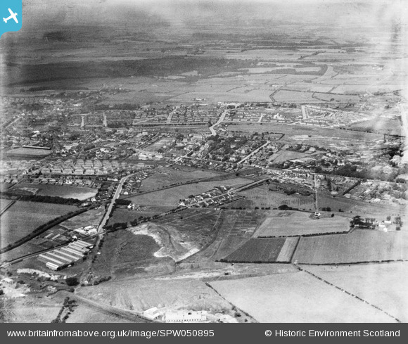
SPW050895 SCOTLAND (1936). Airdrie, general view, showing South Biggar Road and Clark Street. An oblique aerial photograph taken facing north.
© Copyright OpenStreetMap contributors and licensed by the OpenStreetMap Foundation. 2026. Cartography is licensed as CC BY-SA.
Details
| Title | [SPW050895] Airdrie, general view, showing South Biggar Road and Clark Street. An oblique aerial photograph taken facing north. |
| Reference | SPW050895 |
| Date | 1936 |
| Link | NRHE Collection item 1257873 |
| Place name | |
| Parish | NEW MONKLAND (MONKLANDS) |
| District | MONKLANDS |
| Country | SCOTLAND |
| Easting / Northing | 276890, 665690 |
| Longitude / Latitude | -3.967602154085, 55.868663695201 |
| National Grid Reference | NS769657 |
Pins

jaypea |
Sunday 20th of November 2016 07:23:16 PM |