
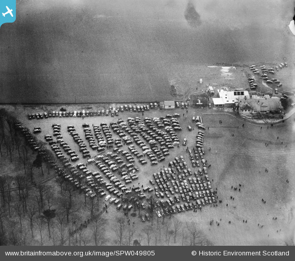
SPW049805 SCOTLAND (1936). Car parking area, launch of the Queen Mary, River Clyde, Glasgow. An oblique aerial photograph.
© Copyright OpenStreetMap contributors and licensed by the OpenStreetMap Foundation. 2025. Cartography is licensed as CC BY-SA.
Details
| Title | [SPW049805] Car parking area, launch of the Queen Mary, River Clyde, Glasgow. An oblique aerial photograph. |
| Reference | SPW049805 |
| Date | 1936 |
| Link | NRHE Collection item 1257803 |
| Place name | |
| Parish | ERSKINE |
| District | RENFREW |
| Country | SCOTLAND |
| Easting / Northing | 243590, 672130 |
| Longitude / Latitude | -4.5030304660563, 55.916825448205 |
| National Grid Reference | NS436721 |
Pins

slowcoach |
Monday 2nd of July 2012 10:31:08 PM | |
|
BigglesH |
Wednesday 27th of June 2012 03:37:06 PM | |
|
BigglesH |
Wednesday 27th of June 2012 03:33:57 PM |
User Comment Contributions
Dear all, That's great; we've reviewed your comments and thanks to your help we can update the catalogue. I have used modern aerial photography and a digitised copy of the 3rd edition of the Ordnance Survey to verify the location. As some of you have suggested, it is probable that this was car parking for spectators viewing the Queen Mary launch - they really knew how to jam them in! The revised record will appear here in due course. Brian Wilkinson Britain from Above Activity Officer |
Brian Wilkinson |
Wednesday 29th of August 2012 01:35:05 PM |
These are the spectators coming to watch the Queen Mary depart from John Brown Shipyard on the 24/2/36 |
Southsider |
Saturday 21st of July 2012 09:49:11 PM |
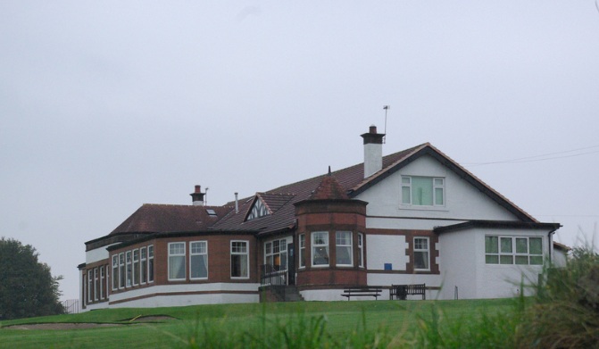
A photo, in Flickr, of the clubhouse does tend to confirm that the present-day location is Erskine Golf Club. http://www.flickr.com/photos/9312357@N04/1748291305/ The event is quite possibly the viewing of a large ship heading down river. The Queen Mary is the most likely candidate as there are other photos which show crowds on the river bank watching her. |
ewnmcg |
Monday 9th of July 2012 11:24:15 AM |
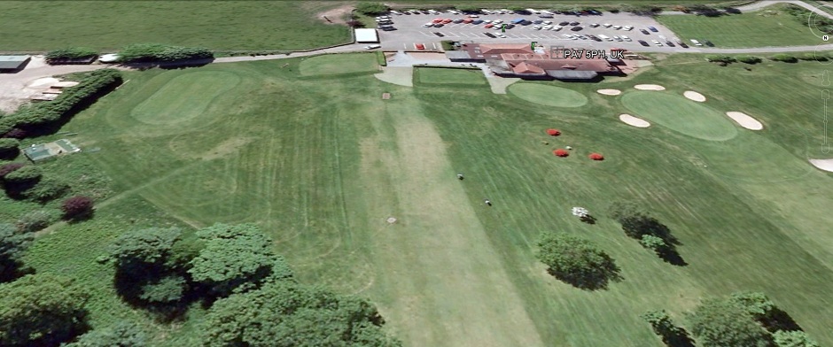
I agree with slowcoach, the Erskine Golf Club building and tree-line on the left corresponds (see screenshot from Google Earth). The people would indeed walk away from the building towards the Clyde. |
BenR |
Sunday 8th of July 2012 07:19:10 PM |
A bit of a guess but if it is close to the Clyde then a distinct possibility is parking for viewing the launch of the Queen Mary from John Brown's at Clydebank, i.e. viewing the launch from the land on the south of the river and near to the entrance of the River Cart. |
ewnmcg |
Saturday 7th of July 2012 11:01:15 PM |
The date suggests this was some of the crowds who flocked to see "Queen Mary" when she left Clydebank for trials etc before entering service later in 1936. |
mannidaze |
Thursday 28th of June 2012 03:32:31 PM |
Cars of varying types. Weather doesn't seem that good. Could it be Ayr racecourse? (Never been there, just deduction). |
BigglesH |
Wednesday 27th of June 2012 03:50:00 PM |