
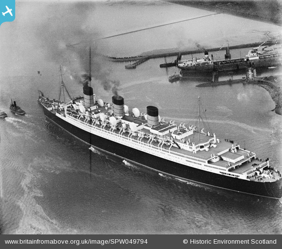
SPW049794 SCOTLAND (1936). Queen Mary, River Clyde, Bowling. An oblique aerial photograph taken facing north.
© Copyright OpenStreetMap contributors and licensed by the OpenStreetMap Foundation. 2026. Cartography is licensed as CC BY-SA.
Details
| Title | [SPW049794] Queen Mary, River Clyde, Bowling. An oblique aerial photograph taken facing north. |
| Reference | SPW049794 |
| Date | 1936 |
| Link | NRHE Collection item 1257794 |
| Place name | |
| Parish | OLD KILPATRICK (DUMBARTON) |
| District | DUMBARTON |
| Country | SCOTLAND |
| Easting / Northing | 243312, 673712 |
| Longitude / Latitude | -4.5083921611595, 55.930937015323 |
| National Grid Reference | NS433737 |
Pins

cell |
Sunday 31st of March 2013 04:52:55 PM |