
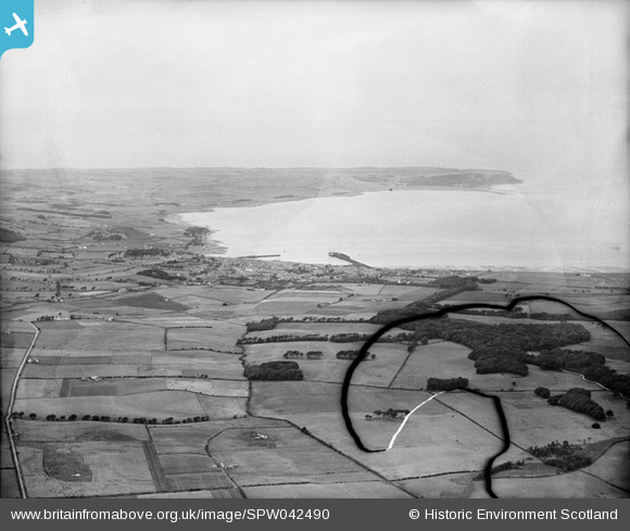
SPW042490 SCOTLAND (1933). Stranraer, general view, showing Loch Ryan and Milleur Point. An oblique aerial photograph taken facing north. This image has been produced from a damaged negative.
© Copyright OpenStreetMap contributors and licensed by the OpenStreetMap Foundation. 2025. Cartography is licensed as CC BY-SA.
Details
| Title | [SPW042490] Stranraer, general view, showing Loch Ryan and Milleur Point. An oblique aerial photograph taken facing north. This image has been produced from a damaged negative. |
| Reference | SPW042490 |
| Date | 1933 |
| Link | NRHE Collection item 1259483 |
| Place name | |
| Parish | MARITIME - DUMFRIES AND GALLOWAY |
| District | MARITIME |
| Country | SCOTLAND |
| Easting / Northing | 205704, 562673 |
| Longitude / Latitude | -5.0321725323539, 54.920789724491 |
| National Grid Reference | NX057627 |
Pins
Be the first to add a comment to this image!