
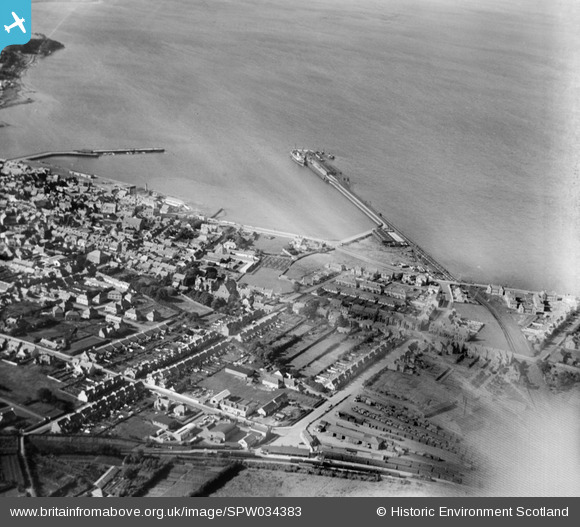
SPW034383 SCOTLAND (1930). Stranraer, general view, showing Stranraer Harbour and Lochryan Street. An oblique aerial photograph taken facing north.
© Copyright OpenStreetMap contributors and licensed by the OpenStreetMap Foundation. 2025. Cartography is licensed as CC BY-SA.
Details
| Title | [SPW034383] Stranraer, general view, showing Stranraer Harbour and Lochryan Street. An oblique aerial photograph taken facing north. |
| Reference | SPW034383 |
| Date | 1930 |
| Link | Canmore Collection item 1257109 |
| Place name | |
| Parish | INCH |
| District | WIGTOWN |
| Country | SCOTLAND |
| Easting / Northing | 206390, 560898 |
| Longitude / Latitude | -5.0202893315459, 54.905125783369 |
| National Grid Reference | NX064609 |
Pins
Be the first to add a comment to this image!