
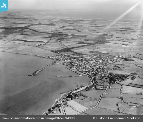
SPW034380 SCOTLAND (1930). Stranraer, general view, showing Stranraer Harbour and Culhorn. An oblique aerial photograph taken facing east.
© Copyright OpenStreetMap contributors and licensed by the OpenStreetMap Foundation. 2025. Cartography is licensed as CC BY-SA.
Details
| Title | [SPW034380] Stranraer, general view, showing Stranraer Harbour and Culhorn. An oblique aerial photograph taken facing east. |
| Reference | SPW034380 |
| Date | 1930 |
| Link | NRHE Collection item 1257106 |
| Place name | |
| Parish | INCH |
| District | WIGTOWN |
| Country | SCOTLAND |
| Easting / Northing | 206793, 560482 |
| Longitude / Latitude | -5.0137331667349, 54.901548196745 |
| National Grid Reference | NX068605 |
Pins
Be the first to add a comment to this image!