
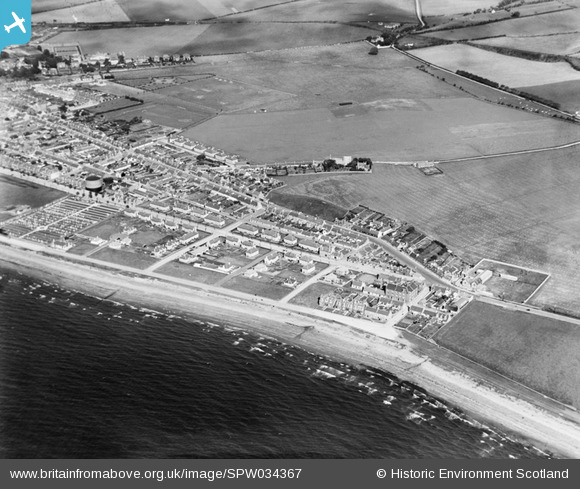
SPW034367 SCOTLAND (1930). Girvan, general view, showing Glendoune Street and Edmiston Drive. An oblique aerial photograph taken facing east.
© Copyright OpenStreetMap contributors and licensed by the OpenStreetMap Foundation. 2025. Cartography is licensed as CC BY-SA.
Details
| Title | [SPW034367] Girvan, general view, showing Glendoune Street and Edmiston Drive. An oblique aerial photograph taken facing east. |
| Reference | SPW034367 |
| Date | 1930 |
| Link | NRHE Collection item 1257088 |
| Place name | |
| Parish | GIRVAN |
| District | KYLE AND CARRICK |
| Country | SCOTLAND |
| Easting / Northing | 218460, 597080 |
| Longitude / Latitude | -4.8553147031953, 55.234427996834 |
| National Grid Reference | NX185971 |
Pins

Girvanbhoy |
Friday 1st of October 2021 07:14:54 PM | |
|
ballantrae history |
Saturday 4th of May 2013 07:47:13 PM | |
|
McWhirter |
Wednesday 18th of July 2012 10:44:35 PM |