
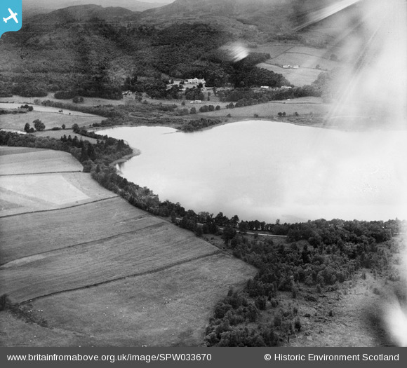
SPW033670 SCOTLAND (1930). Loch of Butterstone and Cardney House, Dunkeld. An oblique aerial photograph taken facing north-west.
© Copyright OpenStreetMap contributors and licensed by the OpenStreetMap Foundation. 2025. Cartography is licensed as CC BY-SA.
Details
| Title | [SPW033670] Loch of Butterstone and Cardney House, Dunkeld. An oblique aerial photograph taken facing north-west. |
| Reference | SPW033670 |
| Date | 1930 |
| Link | NRHE Collection item 1257015 |
| Place name | |
| Parish | DUNKELD AND DOWALLY |
| District | PERTH AND KINROSS |
| Country | SCOTLAND |
| Easting / Northing | 305260, 745370 |
| Longitude / Latitude | -3.5428909866636, 56.590777441141 |
| National Grid Reference | NO053454 |
Pins
Be the first to add a comment to this image!